The 3D model of the Geological Sheet "Fossombrone"
Fossombrone
The 3 dimensional representation of the sheet 280 Fossombrone (Geological Map of Italy at the 1:50,000 scale) represents the attempt to reconstruct and visualize in 3dimension geological data for a wide area (600 km2) from the CARG database (1:25,000 scale).
The area of the sheet 280 Fossombrone, which was surveyed by the Geological Survey of Italy in collaboration with the University of Urbino and the University of Siena, has been selected for the great and direct availability of surface data combined with the availability of subsurface data (wells and seismics) kindly provided from ENI S.p.A. - div. AGIP.
The 3D geological model was realized in the frame of a collaboration between Geological Survey of Italy and the University of Urbino (L.In.E.E. Laboratory of Information-tech for Earth and Environment).
The defined workflow optimizes the use of field data (boundaries, azimuth and dip, tectonics), both surface and subsurface; these data, providing essential constraints to construct 3D model, are integrated with geological cross-sections and seismic reflection profiles, when availables. The 3D model honours all the available data.
|
|
|
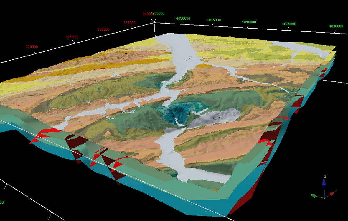
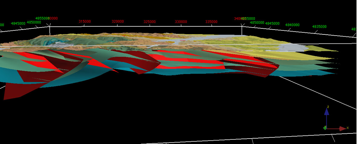
The results highlight the full applicability of the 3D modelling techniques in areas where the CARG database is available. The degree of detail of the CARG database enables the 3d reconstruction of geo-realistic models of subsurface structures and their integrated visualization with outcropping geological data. These techniques allow further analyses to be carried out - such as of fluid migration and potential sediment flow pathway – that are useful towards implementing better solutions and decisions in environmental and risk management.
Published papers
- F. Borraccini, M. De Donatis, C. D’Ambrogi & M. Pantaloni (2004) – Il Foglio 280-Fossombrone 3D: un progetto pilota per la cartografia geologica nazionale alla scala 1:50.000 in tre dimensioni. Boll. Soc. Geol. It., 123, 319-331.
- C. D’Ambrogi, M. Pantaloni, F. Borraccini & M. De Donatis (2004) - 3D geological model of the sheet 280 Fossombrone (Northern Apennines) - Geological Map of Italy 1:50,000. In G. Pasquarè, C. Venturini & G. Groppelli Eds., Atlas “Mapping geological in Italy”. APAT. 193-198. S.E.L.CA. Firenze.
- M. De Donatis, S. Jones, M. Pantaloni, M. Bonora, F. Borraccini, G. Gallerini & C. D'Ambrogi (2002) - A national project of three-dimensional geology of Italy: 3D model of Monti della Cesana from sheet 280 – Fossombrone. Episodes, vol. 25, n. 1, 29-32.