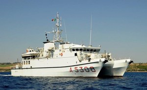
The Hydrographic Units in support of the PNRR-MER projects
In the field of marine protection of the seabed and the restoration of maritime and coastal ecosystems, the Navy has always been a protagonist and continues to demonstrate great presence and commitment. With the new collaboration agreement signed between the Italian Navy (MMI) - Istituto Idrografico della Marina (IIM) and ISPRA, a massive large-scale bathymetric mapping intervention is now underway along the entire Italian coasts. There are many objectives pursued within the project.
Among the most ambitious are the mapping and monitoring of coastal habitats, the updating of the national tide gauge network and the creation of a national network of offshore buoys for the observation of wave motion and marine currents, the restoration of Posidonia meadows oceanica and the use of innovative topographic and bathymetric mapping systems capable of reducing acquisition times and therefore creating new study and work opportunities.

