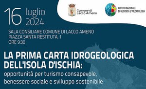
Presentation of the first hydrogeological map of the island of Ischia
On Tuesday 16 July, in the Council Room of the Municipality of Lacco Ameno (Ischia, NA), the presentation of the first Hydrogeological Map of the Island of Ischia will be held.
The new Map is the result of the rigorous and accurate work of the experts of the Vesuvian Observatory of the National Institute of Geophysics and Volcanology (INGV-OV) and of the Department of Earth, Environmental and Resource Sciences (UniNA - DiSTAR) of University of Napoli Federico II, represents an essential tool for understanding and managing the island's territory.
- https://www.isprambiente.gov.it/en/news/presentation-of-the-first-hydrogeological-map-of-the-island-of-ischia
- Presentation of the first hydrogeological map of the island of Ischia
- 2024-07-16T00:00:00+02:00
- 2024-07-16T23:59:59+02:00
- On Tuesday 16 July, in the Council Room of the Municipality of Lacco Ameno (Ischia, NA), the presentation of the first Hydrogeological Map of the Island of Ischia will be held. The new Map is the result of the rigorous and accurate work of the experts of the Vesuvian Observatory of the National Institute of Geophysics and Volcanology (INGV-OV) and of the Department of Earth, Environmental and Resource Sciences (UniNA - DiSTAR) of University of Napoli Federico II, represents an essential tool for understanding and managing the island's territory.
- When Jul 16, 2024 (Europe/Berlin / UTC200)
- Where Lacco Ameno, Ischia
-
Add event to calendar
iCal
The participation of the Head of the Service for Structural and Marine Geology, Surveying and Geological Mapping of ISPRA is expected.

