Events and News

VI Summer School of Geomorphology, Ecology and Biology in marine and insular environments
Sep 08, 2025 — Sep 13, 2025The Summer School of Geomorphology, Ecology and Biology in Marine and Insular Environments was created with the aim of providing advanced training and scientific updating to master's students, doctoral students, researchers and technicians working in the environmental sector. The multidisciplinary training offer is developed through lectures and practical exercises, in the various themes of geological, biological and natural sciences applied to the coastal marine environment. Particular attention will be given to the new technologies used in the study of these ecosystems, characterized by high vulnerability and strongly influenced by the effects of climate change, given their position on the border between the marine and continental domains.
Landslides: What we know and what we do to defend ourselves; what we should know and do to defend ourselves better
Jun 05, 2025 09:00 AM — Jun 05, 2025 05:00 PM Rome, - Palazzo Corsini - Via della Lungara 10XLII Enivorment Day
On June 5, on the occasion of World Environment Day, the Accademia Nazionale dei Lincei organizes the conference "Landslides: what we know and what we do to defend ourselves; what we should know and do to defend ourselves better". The aim of the meeting is to take stock of the knowledge and technological capabilities to recognize, map, monitor and predict landslides and their impacts; to evaluate the obstacles to a full application of the available knowledge and technologies; to identify and analyze the knowledge gaps and the technological and organizational needs; and to indicate possible research and technological development activities, as well as organizational and management ones, for a more effective risk reduction, in the context of ongoing and expected environmental, climatic, economic and social changes.

XVII National Mining Day
May 24, 2025 — May 25, 2025 All Italian territoryNational Mining Day, the annual event dedicated to the valorization and promotion of mining tourism as a cultural heritage, celebrates its XVII edition this year, testifying to an ever-growing interest throughout Italy.
The initiative is promoted by REMI, ISPRA, in cooperatio with AIPAI, ANIM, ASSORISORSE, G&T, MASE and with the sponsorship of prestigious istitutions such as European Route of Industrial Heritage ERIH, Consiglio Nazionale dei Geologi CNG, EuroGeoSurveys EGS, and AMODO Alleanza per la Mobilità dolce
Also for this edition, the Day will take the form of a rich program of events distributed throughout the country, culminating in the creation of a "National Calendar" that will collect all the initiatives proposed by participating Sites, Museums and Mining Parks.
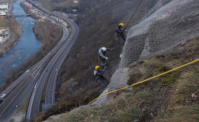
From residual risk to acceptable risk: new perspectives in landslide risk management
May 16, 2025 09:00 AM — May 16, 2025 06:00 PM Rome, Sala Convegni CNR, Piazzale Aldo Moro, 7On May 16, 2025, ISPRA is organizing, together with CNR, ARPA Lombardia, the Autonomous Region of Valle d'Aosta, the Autonomous Region of Friuli Venezia Giulia, the Autonomous Province of Bolzano, the Autonomous Province of Trento, the University of Milan Bicocca and the National Council of Geologists and Engineers, a conference on hydrogeological instability entitled "From residual risk to acceptable risk: new perspectives in landslide risk management".

Territories in transformation
May 13, 2025 09:30 AM — May 13, 2025 01:00 PM Rome, Palazzo Valentini, via IV Novembre, 119/aPresentation of the ISPRA Atlas 2025
The new edition of the ISPRA Atlas "Territories in transformation" is dedicated to the analysis of the state of the national territory, to the study of its most recent transformation dynamics and to their representation through a series of cartographic tables produced using mainly ISPRA-SNPA data and the Copernicus services for monitoring the territory through Earth observation.
Program available soon

Environment and climate
Apr 17, 2025 03:00 PM — Apr 17, 2025 06:00 PM Rome, Orto Botanico, Largo Cristina di SveziaEnvironment and climate is the title of the fourth meeting organized by Roma Ricerca Roma. While land consumption in Rome continues to grow, the European Regulation 2024/1991 on Nature Restoration on the contrary establishes the protection of green “empty” residues, inside the built environment, to respond to increasingly pressing needs for climate adaptation, flood control and heat island reduction.

The Land is over. Uses, reuses and abuses of the soil
Apr 04, 2025 10:00 AM — Apr 04, 2025 02:00 PM Caserta/onlineThe Department of Political Sciences of the University of Campania "Luigi Vanvitelli" is organizing the conference on April 4th in Caserta "The Land is over. Uses, reuses and abuses of the soil".
Michele Munafò, Head of the Service for the National Environmental Information System of ISPRA, will participate at the conference.
6th RaStEM Workshop: a support tool for the design of hydrogeological risk mitigation interventions
Apr 03, 2025 09:30 AM — Apr 03, 2025 02:00 PM Firenze, Auditorium di Santa ApolloniaRaStEM- Standardized Representation of Mitigation Effects - is a web gis tool developed by ISPRA with the dual purpose of guiding designers to a clear and homogeneous representation of the significant elements of a hydrogeological risk mitigation intervention and supporting them in drafting projects consistent with the criteria established by current legislation (DPCM 27/09/2021) for their financing by the Ministry of the Environment and Energy Security (MASE).
Memorandum of Understanding between ISPRA and the Po River Basin Authority to deepen the hydrogeological knowledge of the territory
Apr 03, 2025 — Apr 03, 2025The President of ISPRA Stefano Laporta and the Secretary General of the Po River District Basin Authority Alessandro Bratti have signed a memorandum of understanding, lasting five years. The collaboration, aimed at deepening and experimenting with scientifically complex issues in the Po River district, also includes actions necessary for an effective use of resources and for the subsequent adoption of a shared strategy, within the scope of the respective institutional competences.
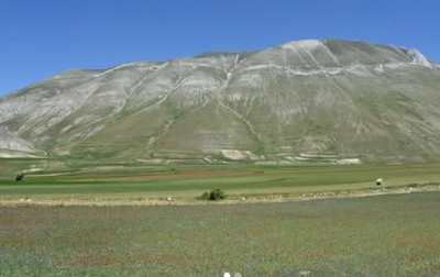
Second edition of the "Virtual Conference on Geoconservation"
Mar 27, 2025 — Mar 29, 2025 OnlineThe second edition of the "Virtual Conference on Geoconservation" is organized by the ProGEO South-Western Europe working group which includes Andorra, France, Italy, Portugal and Spain. The event is organized in collaboration with ISPRA, University La Sapienza of Rome and University of Perugia.
The conference will be held on 27-28-29 March and is online and free participation.
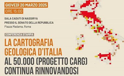
The geological cartography of Italy at 50,000 (CARG Project) continues to be renewed
Mar 20, 2025 03:00 PM — Mar 20, 2025 05:00 PM Rome, Senate of the RepublicThe press conference entitled: The geological cartography of Italy at 50,000 (CARG Project) continues to be renewed - Presentation of the geological sheets "Castel del Piano" and "Mirandola".
Water: the priority of recovery and reuse
Mar 13, 2025 10:00 AM — Mar 13, 2025 01:00 PM Rome, Sala della Protomoteca, Piazza del CampidoglioThe Climate Adaptation Strategy of Rome Capital approved on 14 January 2025 identifies among the priorities the efficient management of water resources and the recovery, reuse and recycling of water as the essential measures to significantly and structurally reduce the consumption of drinking water.
The conference will examine the objectives and challenges to adapt the territory of Rome Capital and water management to a scenario of more frequent and intense climate change and drought and will explore the projects in the field and to be launched to enhance the advanced concept of recovery, reuse and recycling for all compatible uses.
Italian Geothermal Forum
Mar 11, 2025 — Mar 12, 2025 RomeThe event promotes the debate on the state and prospects of geothermal energy, stimulating discussion between institutions, research, industry, professionals and territories. The development of this sector is strategic to accelerate the transition towards energy security and climate neutrality.
The program includes the holding of plenary sessions aimed at exploring current and future energy policy and market scenarios, on a national and European scale. The discussion will also have the participation of representatives of national and regional institutions.
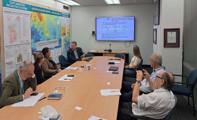
EXA - Energy Exchange Australia
Mar 11, 2025 — Mar 13, 2025 PerthFrom 11 to 13 March EXA - Energy Exchange Australia will be held in Perth and ISPRA Department for the Geological Survey of Italy will participate at the invitation of the Italian Consulate in a series of bilateral meetings with government agencies such as the Geological Survey of Western Australia and companies. The aim is cooperation in the field of mineral research and georesources. The sharing of sustainability protocols in the mining sector, recycling and reuse of critical and strategic raw materials.
5th RaStEM Workshop: a support tool for the design of hydrogeological risk mitigation interventions
Mar 04, 2025 — Mar 04, 2025 Cagliari UniversityRaStEM - Standardized Representation of Mitigation Effects - is a web gis tool, developed by ISPRA as part of the activities envisaged by an agreement stipulated with the General Directorate General Directorate for Energy Incentives of MASE and ISPRA, with the dual purpose of guiding designers to a clear and homogeneous representation of the significant elements of a hydrogeological risk mitigation intervention and supporting them in the drafting of projects consistent with the criteria established by current legislation (DPCM 27/09/2021) for their financing by the Ministry of the Environment and Energy Security (MASE).
Presentation of the first results for the project FPCUP User Uptake of Copernicus Services for Landscape and Spatial Planning Stakeholders
Feb 27, 2025 09:30 AM — Feb 27, 2025 01:00 PM Rome, ISPRA headquartersOn 27 February ISPRA will present the first results of the FPCUP project "User Uptake of Copernicus Services for Landscape and Spatial Planning Stakeholders".
The project is part of the work program of the FPCUP consortium - Framework Partnership Agreement for Copernicus User Uptake - started in 2018, coordinated by DLR (German Aerospace Center) with funding from the EC, and which includes 50 partners from 23 European countries.
The primary objective of FPCUP projects is to increase the number of Copernicus users and applications derived from Copernicus products and services based on user needs. Five European partners, CBK - Poland, IES – Latvia, DGT – Portugal, SRTI-BAS – Bulgaria, IHCantabria – Spain, are participating together with ISPRA in the “User Uptake of Copernicus Services for Landscape and Spatial Planning Stakeholders” project.
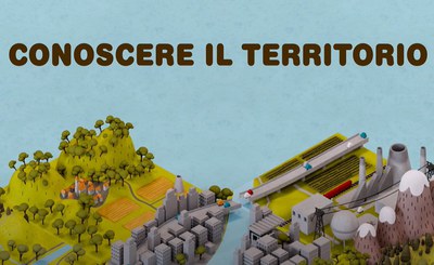
Knowledge the territory - Cartoon Geosciences IR
Feb 18, 2025Knowledge the territory is essential to develop good land management practices, reduce risks, consciously manage natural resources, guarantee the safety of citizens. This knowledge is developed thanks to the most advanced technologies that allow the acquisition of highly detailed data on the earth's surface and underground and the construction of three-dimensional (3D) geological models.
What are they, how are they built, why are 3D geological models of the subsurface so important and where can we find them?
The videos answer these questions, illustrating in a simple way how underground geological and geophysical data are collected, analyzed and processed, how the software that allows geologists to build 3D geological models work, why they are so important for technicians, decision-makers and citizens, and how the GeoSciences IR infrastructure and its Geo-IT3D node allow the retrieval of geological and geothematic data in open format.
New web site Copernicus-Italia.it
Feb 13, 2025The new web site www.copernicus-italia.it dedicated to national activities in the context of the developments of the European Copernicus Earth Observation Program is online, providing complete, free and open access to data and information deriving from the integration of satellite data with in situ data and forecast models.
The new CARG Geological Sheets: Arezzo, Bibbiena, Castel del Piano, Poggibonsi
Feb 12, 2025 10:00 AM — Feb 12, 2025 04:30 PMOn 12 February, the Tuscany Region and the ISPRA Geological Service are organizing the conference "The new CARG Geological Sheets: Arezzo, Bibbiena, Castel del Piano, Poggibonsi" in Florence.
The conference is organized in collaboration with the Universities of Tuscany and the CNR and is APC accredited for geologists registered with the Order of Geologists of Tuscany.
4th RaStEM Workshop: a support tool for the design of hydrogeological risk mitigation interventions
Feb 12, 2025 09:30 AM — Feb 12, 2025 01:30 PM Trieste, MIB Trieste School of Management, L.go Caduti di Nassiria 1RaStEM - Standardized Representation of Mitigation Effects - is a web gis tool developed by ISPRA with the dual purpose of guiding designers to a clear and homogeneous representation of the significant elements of a hydrogeological risk mitigation intervention and supporting them in the drafting of projects consistent with the criteria established by current legislation (DPCM 09/27/2021) for their financing by the Ministry of the Environment and Energy Security (MASE).
Contaminated Sites. Experience in rehabilitation interventions
Feb 12, 2025 — Feb 14, 2025The XVI Edition of the SiCon Workshop “Contaminated Sites. Experiences in rehabilitation interventions” will take place in Brescia on 12, 13 and 14 February 2025 at the Faculty of Engineering of the University of Brescia. The SiCon is organized by the Sanitary-Environmental Engineering groups of the University of Brescia, the University of Catania and SAPIENZA University of Rome, in collaboration with ANDIS (National Association of Sanitary-Environmental Engineering), the GITISA (Italian Group of Sanitary-Environmental Engineering) and the CSISA Onlus (Study Center for Sanitary-Environmental Engineering) of Catania.
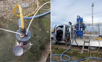
New ISPRA publications on remediation technologies: Multiphase Extraction (MPE) and Soil Washing (SW)
Feb 07, 2025ISPRA has recently published two new technical reports dedicated to the Multiphase Extraction (MPE) and Soil Washing (SW) remediation technologies, developed within the activities of the IMPEL network (European Union Network for the Implementation and Enforcement of Environmental Law). These documents represent an important contribution to the dissemination of innovative solutions for the sustainable management of contaminated sites, promoting alternative methodologies to traditional excavation and landfill disposal interventions.
Winter School on Environmental Impact Assessment
Feb 06, 2025The call for participation in the Winter School on Environmental Impact Assessment in collaboration with La Sapienza di Roma has been published. The activity includes frontal and laboratory teaching and is reserved for university and PhD students. The topics addressed in this edition: surface waters; excavated earth and rocks.
Registration deadline: February 20th.
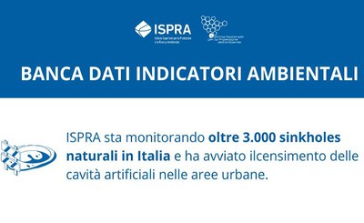
Areas subject to sinkholes - ISPRA Environmental Indicators Data base
Jan 29, 2025Sinkholes are chasms that suddenly open in the ground, with diameters that can reach hundreds of meters.
Depending on the causes from which they originate, they are divided into sinkholes of natural origin and sinkholes of anthropogenic origin.
According to ISPRA data, the regions most exposed to natural sinkholes include Friuli-Venezia Giulia, Lazio, Puglia, Campania and Toscana, while cities such as Rome, Naples and Cagliari are particularly vulnerable to sinkholes caused by human activities.
Environment and health: Research projects for sustainable development
Jan 24, 2025 10:15 AM — Jan 24, 2025 04:30 PM PescaraOn the occasion of the 25th anniversary of ARTA Abruzzo, a study conference dedicated to the topic of environment and health will be held on Friday 24 January in Pescara, which will offer a space for discussion, open to all citizens, on ongoing initiatives and research to ensure a sustainable future, with particular attention to environmental protection and community well-being.
New update of the ISPRA indicators database
Jan 17, 2025More than 200 indicators from the ISPRA environmental indicators database have been updated, the objective is to promote greater environmental awareness and involve the scientific community, in particular that of environmental statistics and information, in the crucial environmental issues of our time.
The database of environmental indicators, organized into 39 environmental themes, with over 300 indicators (ISPRA core set), is the most complete collection of statistical data and information on the state of the environment in Italy created and managed by the Institute for the Protection and Environmental Research (ISPRA) in collaboration with regional agencies and autonomous provinces within the National System for Environmental Protection (SNPA).
The indicators, classified under Environmental Themes, are structured in sheets containing descriptive information (metadata) such as, for example, the objectives to be achieved, the assessment of the state, the trend and data represented with graphs, tables and maps.

Protection and enhancement of industrial and archaeological-mining heritage
Dec 20, 2024 09:30 AM — Dec 20, 2024 01:30 PM MiC, Ministero della cultura - Rome via di San Michele18Friday 20 December 2024 from 09:00 will be held at the ICCD - Central Institute for the Catalog and Documentation (MiC, Ministry of Culture), in Rome, in via di San Michele 18,the conference "Protection and Enhancement of Industrial and Archaeo-Mineral Heritage".
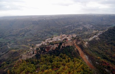
Innovation and transformation in landslide risk management in Italy
Dec 18, 2024 — Dec 18, 2024 Rome, Aula Magna CNRThe aim of the event is to verify the state of knowledge in the characterization and perimeter of landslide phenomena, over 20 years after the promulgation of the laws establishing the hydrogeological management plans (PAI). These plans, initially focused on the knowledge and delimitation of the areas at risk, have seen a regulatory evolution that has refined the fields of application, as highlighted by the Prime Ministerial Decree of 8 May 2015. However, the lack of uniform criteria in the definition of landslide risk remains a critical point. More than a quarter of a century after the founding laws, there is a need to review the methodological approaches that led to the current cognitive framework in light of scientific advances, regional inhomogeneities, innovative technologies, climate changes and new legislation.
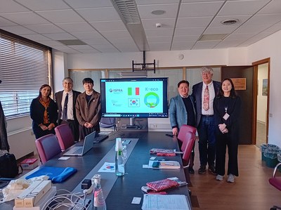
Technical visit of the Korea Environment Corporation to ISPRA
Dec 17, 2024 — Dec 17, 2024 Rome, ISPRA headquartersOn 17 December 2024, a technical visit took place at the ISPRA headquarters by a delegation from the Korea Environment Corporation (South Korea), composed of the Director of the Soil and Groundwater Department and officials from his staff. The delegation met the Director of the Geological Survey of Italy, Dr. Marco Amanti, and other ISPRA experts for a discussion on the management of contaminated sites.
The Korea Environment Corporation is an organization that operates under the supervision of the Korean Ministry of the Environment, with the mandate to promote environmental health and develop projects to combat pollution and climate change. Every year, the organization analyzes the policies adopted at an international level regarding the management of contaminated sites; for 2024, Italy has been identified as the subject of in-depth analysis.
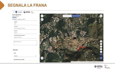
"Report the landslide" and the IdroGEO national platform for knowledge of the territory
Dec 11, 2024 09:30 AM — Dec 11, 2024 04:00 PM Genova, Palazzo Ducale, Sala “Enrico Piccardo”, Piazza Matteotti 9 and Streaming liveThe event, organized by ANCI, the Liguria Region and ISPRA, is an opportunity to discuss with the Municipalities on the prevention of hydrogeological risk. Knowledge and updating of information on landslides are fundamental to effective risk prevention and management policies. The use of ISPRA operational tools will be explored in depth to support risk mitigation policies, territorial planning, planning of soil protection interventions and infrastructure design, with the aim of increasing community resilience and awareness. of citizens on local risks.
