Events and News
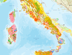
The new Hydrogeological Map of Italy at 1:500,000 scale: Comparison with the territory
Sep 18, 2024 10:00 AM — Sep 18, 2024 01:00 PM FerraraAs part of the RemTech Expo event, ISPRA is organizing the conference "The new hydrogeological map of Italy at the 1:500,000 scale: comparison with the territory".
The joint research by ISPRA and the University of Milan aims to homogenize the knowledge and available data, leading to the creation of the new Hydrogeological Map of Italy at a scale of 1:500,000 on the available cartographic basis.
The map will thus be able to enhance a wealth of knowledge which, at the moment, is fragmented and non-homogeneous and therefore not very usable and useful for management assessments and modeling of future scenarios of availability of underground water resources at a national level.
ISPRA in RemTech Expo 2024
Sep 18, 2024 — Sep 20, 2024 FerraraFrom 18 to 20 September the XVIII Edition of RemTech Expo will be held in Ferrara, the Environmental Technological Hub specialized in the themes of restoration, regeneration and sustainable development of territories. This year too ISPRA will participate in numerous meetings.
There are ten segments that make up the event: REMTECH and REMTECH EUROPE remediation of contaminated sites, COAST coastal protection, ports, sustainability, ESONDA hydrogeological instability, floods, landslides, CLIMETECH climate change, mitigation, adaptation, GEOSISM seismic risk, prevention, reconstruction , INERTIA sustainable works materials, circular economy, RIGENERACITY urban regeneration, CHEMTECH innovative and sustainable chemical industry and FIRE prevention-innovation-research, fire prevention and safety of the Italian Cultural Heritage - and a special HUTTE segment dedicated to the themes of sustainability and integral well-being.
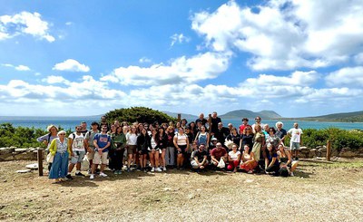
Summer school of Geomorphology, Ecology and Biology in marine and insular environments
Sep 09, 2024 — Sep 14, 2024ISPRA, in collaboration with the Department of Engineering and Geology of the “G. d'Annunzio" of Chieti-Pescara and the Department of Earth Sciences of Sapienza, University of Rome, organize the V Summer School of Geomorphology, Ecology and Biology in marine and insular environments - Asinara Island, 9-14 September 2024 with the patronage of the Italian Geological Society and its Marine Geology Section, of the Italian Association of Geomorphology (AIGEO), of the Asinara National Park, of the “Isola dell'Asinara” Marine Protected Area and of the Municipality of Porto Torre
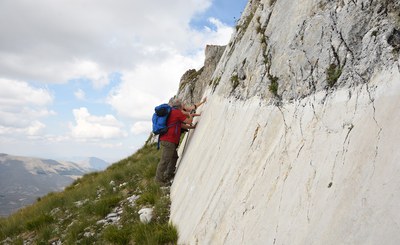
The Monte Vettore Fault recognized as a world geological heritage on the proposal of ISPRA
Sep 06, 2024The geosite was included in the list of the 200 geological sites with the highest scientific value of the IUGS Geological Heritage
Responsible for the seismic sequence that hit Central Italy in 2016, the Monte Vettore Fault extends along the highest peak of the Sibillini Mountains.
To enhance its scientific relevance, ISPRA and the Sibillini Mountains National Park have identified and set up some observation points for surface faulting, i.e. the breaking of the ground surface generated by the fault.
ISPRA then worked on the candidacy for inclusion in the list of the 200 geological sites of the highest scientific value in the world drawn up by the International Union of Geological Sciences
GeoSciences IR. A Research Infrastructure for the Italian Geological Services Network
Sep 02, 2024 02:00 PM — Sep 02, 2024 05:00 PM Università degli Studi di Bari “Aldo Moro”The GeoSciences IR project financed by the National Recovery and Resilience Plan - PNRR has the objective of developing a research infrastructure designed to meet the needs of the Regional Geological Services. The project is carried out by a consortium made up of 3 research institutes and 13 universities, led by ISPRA, the Geological Survey of Italy. The infrastructure will provide for at least ten years open access to data, services, tools and e-learning modules relating to 12 topics in the field of geological sciences, identified as priorities by the Regional Geological Services, target users of the infrastructure. Among these: i) geological and geothematic mapping, 3D modeling and marine geology; ii) mapping, monitoring and management of geological risks; iii) exploration, exploitation and sustainability of georesources.
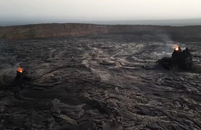
Flying over the Dancalia - When geology amazes us
Sep 02, 2024On the occasion of the conference "The contribution of Italian geologists in the exploration of the Afar" organized by ISPRA in collaboration with the Italian Geological Society and the Italian Geographical Society on 7 June 2024 in Rome, the reportage created with 4K aerial images of this region where it is possible to admire an incredible variety of natural landscapes, originating from geological processes that have been ongoing for millions of years. The conference was a day of in-depth study on the role played by the Italian scientific community, and in particular by geologists, in the exploration of the Dancalia region (East Africa).
Landslides and floods: ISPRA's activities
Aug 29, 2024On 27 August 2024, the provinces of Caserta, Benevento and Avellino were hit by strong storms that caused landslides and rivers of mud in various locations. Irpinia was particularly affected where in San Felice Cancello the streets of the hilly hamlet of Talanico were invaded by a river of mud and debris.
Among the institutional tasks of ISPRA is the collection, processing and dissemination of maps and data on hydrogeological instability referring to the entire national territory, making them available to the country for risk prevention and mitigation.
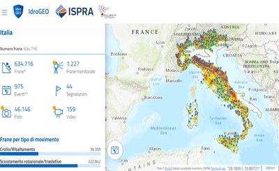
In particular, ISPRA in collaboration with the Regions and Autonomous Provinces, has realized the Inventory of Landslide Phenomena in Italy, in which, to date, over 634,000 landslides have been recorded, representing 2/3 of those in Europe.
.
Every three years ISPRA publishes the Report on hydrogeological instability in Italy which constitutes the official reference framework on the hydrogeological hazard and risk for our country.
The data tell us that the 94% of Italian municipalities are at risk from landslides, floods or coastal erosion, 1.3 million inhabitants are at risk of landslides and 6.8 million inhabitants at risk of floods (ISPRA Report, 2021). We are working on the 2024 edition which will be published early next year.
All data is published on the national IdroGEO platform, an easy tool to use, even with smartphones, to promote greater awareness of the risks affecting one's territory and informed decisions on where to buy one's home or locate new economic activities.
In situ monitoring of landslides is essential to deepen knowledge of landslide phenomena, evaluate the evolution of ongoing phenomena (forecast), support the design of stabilization works and verify their effectiveness over time, correctly plan the territory, activate procedures to alert the population.
In 2021, ISPRA created the National Registry of in situ landslide monitoring systems in order to survey the monitoring networks on the national territory. It is managed in collaboration with Regions, Autonomous Provinces and ARPA and contains information on location, managing entity, monitoring purpose (cognitive/alert), system status (active/decommissioned/under construction), type of acquisition (manual/ continuously), type of monitoring instrumentation.
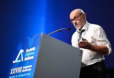
XXVIII National Congress of the Italian Chemical Society
Aug 26, 2024 — Aug 30, 2024 MilanoRaw materials, point of convergence between different sciences
The XXVIII congress of the Italian Chemical Society took place in Milan. In the Chemistry&Society session, ISPRA activity in the sector of critical and strategic raw materials was presented, which has attracted great interest from the Italian Chemical Society. ENEA, CNR and State Police also participated in the session. The meeting can be the prelude to a collaboration for a desirable and necessary sharing of knowledge on a topic that is the basis of our entire development model
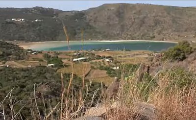
Pantelleria - Volcanic island between past and future
Aug 05, 2024ISPRA Geological Service of Italy is carrying out the survey of the 1:25,000 geological sheet of the island of Pantelleria. In this video, in addition to the beauty of the island, its volcanic history and the difficulties that geologists have to face to create this important geological map emerge. By also interviewing the Director of the Pantelleria National Park, the strategic value that this map also has for the purposes of planning and protection of a unique territory in the world emerges.
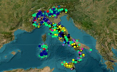
ISPRA presented Gemma
Jul 26, 2024The ISPRA General Director, Maria Siclari, and the President Stefano Laporta on Tele Ambiente presented GeMMA, the geological mining database which collects and harmonizes the data relating to all the deposits.
The database, updated as part of the PNRR GeoSciencesIR project, represents the starting point for the development of the national mining program, imposed by the EU Critical Raw Materials Act Regulation and entrusted to ISPRA.

Critical and strategic raw materials
Jul 24, 2024 09:00 AM — Jul 24, 2024 01:00 PM Rome, ISPRA, via Vitaliano Brancati 60/streaming onlineThe role of ISPRA in light of the new European regulatory framework for the sustainable and circular use of raw materials useful for the ecological and digital transition
One month after the entry into force of the decree, ISPRA launches the national mining program. In total there are 76 mines still active in Italy, 22 relating to materials that are included in the list of 34 critical raw materials of the EU. In 20 of these, feldspar is extracted, an essential mineral for the ceramic industry, and in 2, fluorite (in the municipalities of Bracciano and Silius), which is widely used in the steel, aluminium, glass, electronics and refrigeration. In particular, the Genna Tres Montis fluorspar mine (South Sardegna), which will return to full production at the end of the renovation works, will represent one of the most important in Europe. Of the other 91 fluorspar mines active in the past, some very important ones - to be revalued with current prices quadrupled compared to 1990 - are located in the Bergamo, Brescia and Trentino areas, in addition to those in Sardegna and Lazio
The database GeMMA – Geologico, Minerario, Museale, Ambientale V. 1.0
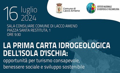
Presentation of the first hydrogeological map of the island of Ischia
Jul 16, 2024 — Jul 16, 2024 Lacco Ameno, IschiaOn Tuesday 16 July, in the Council Room of the Municipality of Lacco Ameno (Ischia, NA), the presentation of the first Hydrogeological Map of the Island of Ischia will be held.
The new Map is the result of the rigorous and accurate work of the experts of the Vesuvian Observatory of the National Institute of Geophysics and Volcanology (INGV-OV) and of the Department of Earth, Environmental and Resource Sciences (UniNA - DiSTAR) of University of Napoli Federico II, represents an essential tool for understanding and managing the island's territory.
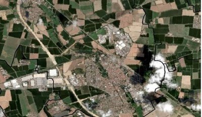
Land take: web application for sharing preliminary data from monitoring activities
Jul 15, 2024ISPRA and the National System for Environmental Protection (SNPA) reserve for the operators of Municipalities and Observatories of the Regions and autonomous Provinces the consultation of the preliminary data deriving from land take monitoring, to make the national data updating process increasingly effective and participatory.
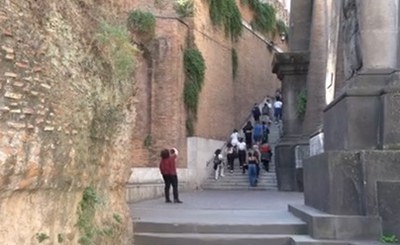
Rome: walking in geodiversity
Jul 08, 2024On 6 October 2023, on the occasion of the second International Day of Geodiversity proclaimed by UNESCO, ISPRA together with the Italian Society of Environmental Geology organized the urban excursion "Rome: walking in geodiversity". The video shows only some of the themes and geosites visited during the urban excursion. The visits with the classes of the Marcello Malpighi Scientific High School will continue in the coming months. This activity is part of the GeoSciencesIR Project in WP2 which also deals with the valorization of the Geological Heritage and the catalog of Italian Geosites.
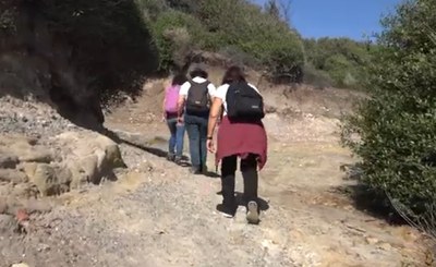
Geological walks with ISPRA - Tor Caldara
Jul 01, 2024Visit to the Tor Caldara Regional Nature Reserve, accompanied by ISPRA researchers, in an area where sulfur was extracted already in Roman times
A walk in the ancient coastal forests of holm oaks, oaks and cork trees, through geology, nature and history, until you reach the sea. The Tor Caldara Nature Reserve is located south of Rome, between Anzio and Lavinio, and represents a geological-environmental treasure chest of unique value. The area constitutes a rare testimony of the ancient coastal forests along the coast of southern Lazio and until recently was exploited for sulfur mining, the presence of which is linked to the secondary activity of the Lazio volcanic district. The excursion led visitors to discover the geological and environmental characteristics of the Reserve, which is particularly suitable for educational purposes due to the spectacular secondary volcanic phenomena still active and the naturalistic importance of the habitats present
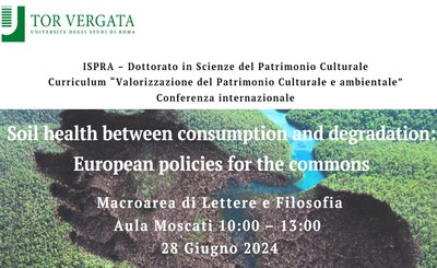
Soil health between consumption and degradation: European policies for the commons
Jun 28, 2024 10:00 AM — Jun 28, 2024 12:30 PM Rome, Università Tor Vergata/Online su TeamsISPRA and the Tor Vergata University, as part of the collaboration on the topic of environmental sustainability in land use and territorial planning, are organizing a first scientific comparison seminar to highlight the relationship between policies, regulations and conditions of the soil.
In-depth analyzes of national, European and international experiences are expected, with reference to the aspects of land degradation, desertification risk, provision of soil ecosystem services, land consumption and sustainable use, with particular reference to target 15.3.1 of the sustainable development objectives ( Sustainable Development Goals - SDGs) of the 2030 Agenda.

How to quickly classify and evaluate geo-climatic problems and city hazards?
Jun 26, 2024 11:45 AM — Jun 26, 2024 01:00 PM WebinarDiscovering the Urban Geo-Climatic Footprint: from its recent innovations to the global application of the tool
The webinar aims to present a new methodology called Urban Geo-Climatic Footprint (UGF) which has been developed to quickly and comprehensively classify cities from a geological and climatic perspective. The method is based on the fundamental assumption that cities with similar geological-geographical environments will face similar challenges, due to both common geological problems and associated climate impacts. The UGF approach was applied to 41 European cities in collaboration with 17 European Geological Services. For those who are already involved in the project and have tested the tool in their cities, this webinar will be interesting for introducing the latest version 9.0 of the tool and its global applicability
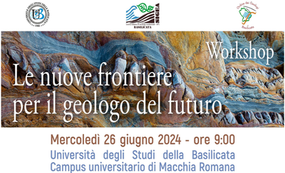
The new frontiers for the geologist of the future
Jun 26, 2024 09:00 AM — Jun 26, 2024 04:30 PM PotenzaThe workshop is organized by SIGEA-APS, in collaboration with the University of Basilicata and the Order of Geologists of Basilicata. At the end there will be a round table "What skills are necessary for the geologists of the future?"
Experts from different sectors from public research bodies, academic, professional and entrepreneurial fields will participate in the event.
Desertification and drought day 2024. Annex IV regional event
Jun 24, 2024 10:00 AM — Jun 24, 2024 12:00 PM On line eventHungary, in its role as Chair of the countries included in the Northern Mediterranean Annex IV of the UNCCD, organized an online event in the context of the celebrations of the World Desertification Day and the thirtieth anniversary of the United Nations Convention to Combat Desertification which took place will be held on June 24th.
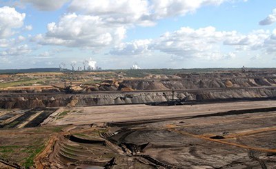
Critical raw materials law decree, the role of ISPRA
Jun 21, 2024Approved on 20 June in the Council of Ministers, the Legislative Decree on the management of critical raw materials which adapts the national system to the provisions of Regulation (EU) 2024/1252 of the European Parliament and of the Council of 11 April 2024. The Legislative Decree introduces urgent provisions to ensure a safe and sustainable supply of critical raw materials.
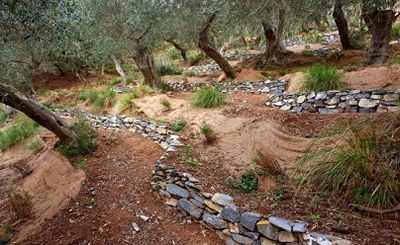
Second National RECONECT Workshop
Jun 19, 2024 09:00 AM — Jun 19, 2024 01:00 PM Genova/onlineNature-based Solutions for meteorological-hydrological risk mitigation: Applications and prospects
The RECONECT project (09/2018 – 08/2024) contributes to improving the European reference framework of Nature-Based Solutions (NBS) for the reduction of meteorological-hydrological risk in natural and rural areas. The project is based on a network of pilot sites, EU and non-EU, which compete with the aim of innovating land management, pursuing objectives of both meteorological-hydrological risk reduction and local and regional development and protection of biodiversity.
Second RASTEM workshop: a support tool for the design of hydrogeological risk mitigation interventions
Jun 18, 2024 09:30 AM — Jun 18, 2024 02:00 PM NapoliRaStEM - Standardized Representation of Mitigation Effects - is a web gis tool developed by ISPRA with the aim of guiding designers to a clear representation of the significant elements of a hydrogeological risk mitigation intervention and supporting them in the drafting of projects consistent with the criteria established by the legislation in force (DPCM 09/27/2021) for their financing by the Ministry of the Environment and Energy Security (MASE).
Study Day 30th Anniversary of the UNCCD Convention
Jun 17, 2024 02:30 PM — Jun 17, 2024 07:00 PM Messina - Roma and onlineJune 17th is the Day against Desertification and Drought, "United for the Earth". Our legacy. Our Future” is the theme chosen for 2024 and highlights the future of land management: our most precious resource for ensuring the stability and prosperity of billions of people around the world.
June 17, 2024 also marks the 30th anniversary of the United Nations Convention to Combat Desertification (UNCCD), the only legally binding international treaty on land management and drought; one of the three Rio Conventions together with climate change and biodiversity.
Desertification and Drought Day 2024
Jun 17, 2024 — Jun 17, 2024Desertification, land degradation and drought are among the most pressing environmental challenges of our time, with more than 40% of all land surface in the world already considered degraded.
A healthy land not only provides us with nearly 95% of our food, but much more: it clothes and shelters us, provides us with jobs and livelihoods, and protects us from worsening droughts, floods, and fires. Yet, every second, an equivalent of four football fields of healthy soil is degraded, totaling 100 million hectares each year.
The Desertification and Drought Day it is celebrated every year on June 17th, “United for the Earth. Our legacy. Our Future” is the theme chosen for 2024 and highlights the future of land management: our most precious resource for ensuring the stability and prosperity of billions of people around the world.
June 17, 2024 will also mark the 30th anniversary of the Bonn-based United Nations Convention to Combat Desertification (UNCCD), the only legally binding international treaty on land management and drought; one of the three Rio Conventions together with climate change and biodiversity.
Desertification and Drought Day has the following objectives:
- Promote public awareness of problems related to desertification, land degradation and drought
- Present human-driven solutions to prevent desertification and reverse drought intensification
- Strengthen the implementation of the United Nations Convention to Combat Desertification.
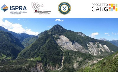
Geological survey and CARG cartography - Summer School 2024
Jun 16, 2024 — Jun 22, 2024 Erto e Casso, Parco delle Dolomiti FriulaneISPRA, in collaboration and with the support of the Italian Geological Society, the Municipality of Erto and Casso, the Friulian Dolomites Natural Park and the Friuli Venezia Giulia Autonomous Region, organizes the 2024 summer school of "Geological survey and CARG cartography" at the Municipality of Erto e Casso, Friulian Dolomites Park from 16 to 22 June 2024.
The Summer School aims to disseminate the methodologies and criteria of geological survey and cartography, conceptual organization of data and digital archiving system in uniformity with the criteria of the CARG Project.
The School includes days of field survey work in small groups followed by experts and will be accompanied by lectures and exercises.

Landscapes and Geological Heritage, Cultural Heritage and Intangible Heritage
Jun 14, 2024 — Jun 16, 2024 Salve (LE)The Italian Society of Environmental Geology (SIGEA) – APS and the Regional Order of Geologists of Puglia in collaboration with the Municipality of Salve (LE) organizes the National Conference "Landscapes and Geological Heritage, Cultural Heritage and Intangible Heritage". The topics addressed will be: land management for the protection of geological heritage; geological heritage of natural and anthropic hypogea; geological landscapes and their evolution; landscapes and different artistic expressions; geological landscapes and food and wine routes.
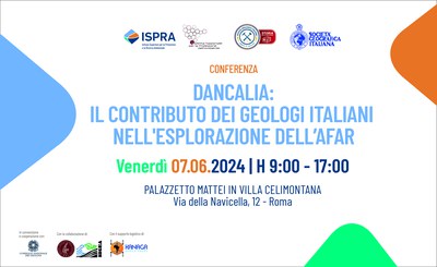
Dancalia: the contribution of Italian geologists in the exploration of the Afar
Jun 07, 2024 09:00 AM — Jun 07, 2024 05:00 PM Rome, Villa CelimontanaThe conference entitled "Dancalia: the contribution of Italian geologists in the exploration of the Afar" will be held in Rome on 7 June. During the day there will be an in-depth analysis of the role played by the Italian scientific community in the exploration of the Danakil region (East Africa). In fact, there are many examples of geologists, explorers and scientists who, from the 19th century to the present day, have traveled the length and breadth of the Afar depression, a desolate region but very rich in geosites: from the Erta Ale volcano to the area of Dallol and the Salt Plain, from the geothermal springs of Alalobed to the Awash valley with the various fossil finds.
During the conference there will be several interventions by various experts, university professors, researchers, geographers and historians, with the aim of enhancing the contribution that the geological community has historically produced on the Dancalia area, in terms of studies, research, discoveries, reports, images and geological and geographical maps, and to share new ideas and lines of research

World Environment Day 2024
Jun 05, 2024 — Jun 05, 2024World Environment Day has been celebrated since 1972 and represents the United Nations' main vehicle for encouraging global awareness and action for the environment.
The 2024 day, hosted by Saudi Arabia, focuses on land restoration, desertification and drought resilience with the slogan “Our land. Our future. We are #GenerationRestoration.
According to the United Nations Convention to Combat Desertification, up to 40% of the planet's land is degraded, directly affecting half the world's population and threatening about half of global GDP ($44 trillion). The number and duration of droughts have increased by 29% since 2000: without urgent action, droughts could affect more than three-quarters of the world's population by 2050.
Land restoration is a key pillar of the United Nations Decade for Ecosystem Restoration (2021-2030), a call for the protection and revival of ecosystems around the world that is critical to achieving the Sustainable Development Goals.
2024 marks the 30th anniversary of the United Nations Convention to Combat Desertification. The sixteenth session of the Conference of the Parties (COP 16) to the United Nations Convention to Combat Desertification (UNCCD) will be held in the Saudi capital, Riyadh, from 2 to 13 December 2024.

The national IdroGeo platform on hydrogeological instability: data and services for the PA and companies
May 30, 2024 09:00 AM — May 30, 2024 01:30 PM Roma, Palazzetto Mattei in Villa CelimontanaISPRA meets decision makers and stakeholders
The conference "The IdroGEO national platform on hydrogeological instability: data and services for the PA and companies - ISPRA meets decision makers and stakeholders", organized as part of the Open Gov Week, will be held on 30 May.
ISPRA will present the balance sheet on data and services provided by the national IdroGEO platform, four years after its launch in May 2020.
The IdroGEO Platform is an open data, open source and multilingual web application that allows you to view, query, download and share maps and data on hydrogeological instability in Italy.
It is a communication and information dissemination tool, to support decisions in the context of risk mitigation policies, territorial planning, preliminary planning of infrastructures, planning of structural soil defense interventions, management of hydrogeological emergencies and of environmental assessments.
As part of the event, the new functions for consulting and sharing hazard data and maps, hydrogeological risk indicators and the Inventory of Landslide Phenomena in Italy will be presented. The event will constitute a moment of meeting and discussion with decision makers, businesses, professions, universities and associations.
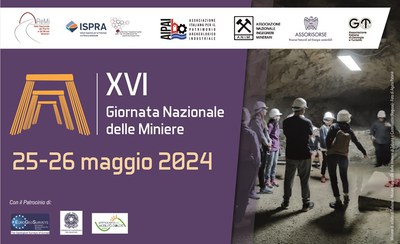
XVI National Mining Day - 2024 Edition
May 25, 2024 — May 26, 2024 National territoryNational Mining Day, promoted to spread the value and cultural significance of mining tourism, has reached its sixteenth edition this year, registering growing interest across the entire national territory. The initiative, organized by REMI, ISPRA SNPA, with MASE, AIPAI, ANIM, ASSORISORSE, G&T and the patronage of Consiglio Nazionale dei Geologi, EuroGeoSurveys e Primavera della Mobilità dolce involves the organization of dedicated events throughout the national territory and the creation of a "national calendar" with all the initiatives promoted by the Sites/Museums and Mining Parks.
