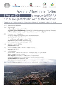
Landslides and floods in Italy: ISPRA maps and the new plaform web of #italiasicura
- https://www.isprambiente.gov.it/en/archive/ispra-events/2016/03/landslides-and-floods-in-italy-ispra-maps-and-the-new-plaform-web-of-italiasicura
- Landslides and floods in Italy: ISPRA maps and the new plaform web of #italiasicura
- 2016-03-02T09:30:00+00:00
- 2016-03-02T13:00:00+00:00
- As a part of the Mission Structure “ Italia Sicura ” with the aim to present the activities carried out by the Institute in this context, the ISPRA presents the "Report on the Hydrogeological instability in Italy: hazard and risk indicators".The Report, elaborated in 2015, provide a comprehensive and updated knowledge on the landslide hazard, hydraulic and coastal erosion of the entire national territory. The report also contains indicators of risk for landslides and flood, relative to population, enterprises, fundamental elements for the planning of structural and non-structural measures of risk mitigation and cohesion policies in the country.
- When Mar 02, 2016 from 09:30 AM to 01:00 PM (GMT+0 / UTC0)
- Where Rome
-
Add event to calendar
iCal
In this context ISPRA, as part of its institutional tasks ( collect, elaborate and spread data relating to soil conservation and hydrogeological instability) and as part of the scientific and technical support activities carried out in the "control room" of the Mission Structure to fight against the hydrogeological instability of Presidency of the Council of Ministers, organizes the conference “ Landslides and Floods in Italy: ISPRA maps ". During the conference it will be presented the first report on ISPRA " Hydrogeological instability in Italy: hazard and risk indicators". The report presents the areas at landslide and flood risk with national and regional data compiled in 2015.
Press release (ita)
Press communication (ita)
Hydrogeological instability in Italy: hazard and risk indicators - Report 2015
Synthesis Report 233/2015 (ita - 2.4 mb)
Streaming Videos and Presentations (ita)

