Aeromagnetic map at 1:1,000,000 scale
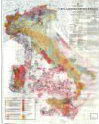
The aeromagnetic map of Italy at the 1:1,000,000 scale, published by the SGN in collaboration with AGIP in 1994, represented a step forward in the process of synthesis of the data acquired during various aeromagnetic surveys carried out by AGIP throughout the territory Italian and surrounding seas, in the years from 1971 to 1980, for oil exploration purposes. The data, acquired with cesium vapor magnetometers at different flight altitudes due to the different altimetric characteristics of the Italian territory, were extended to only two altitudes, 13,300 ft. in the Alps and 8,500 ft. on the remaining territory and connected to each other to obtain the contouring (equidistance 5 nT) of the residual magnetic field anomalies with respect to the IGRF 1976. The c.m.r isoanomals, like the Bouguer isoanomals expressed by the Gravimetric Map at the same scale, were traced with two colors and superimposed on a simplified geological basis represented by the "Mining Map of Italy" at the scale 1:1,000,000 (Geological Service of Italy, Rome, 1973).