Floods and hydrogeological instability: ISPRA's activities
Flood in Emilia Romagna
The rainfall in Emilia Romagna began on the morning of September 17th, continued uninterruptedly throughout the day of the 18th and, albeit with a progressive attenuation of its intensity, is also affecting the area today, September 19th.
The quantities of cumulative rainfall in the first 48 hours of the event were particularly intense, with cumulative values between 150 and 300 mm. In this regard, we are publishing two maps of the cumulative rainfall in the first 48 hours of the event in Emilia-Romagna and the one with the cumulative rainfall in the regional river basins ( Date ARPAE Emilia-Romagna)
Among the institutional tasks of ISPRA is the collection, processing and dissemination of maps and data on hydrogeological instability referring to the entire national territory, making them available to the country for risk prevention and mitigation.
In particular, ISPRA in collaboration with the Regions and Autonomous Provinces, creates the Inventory of Landslide Phenomena in Italy, in which, to date, over 634,000 landslides have been recorded, representing 2/3 of those in Europe.
The Institute prepares the national mosaics of the danger for landslides and floods, based on the Hydrogeological Structure Plans (PAI) and the Flood Risk Management Plans (PGRA), drawn up by the District Basin Authorities. The areas at risk from landslides include, in addition to landslides that have already occurred, also the areas of possible evolution of the phenomena and the areas potentially susceptible to new landslide phenomena.
Every three years ISPRA publishes the Report on hydrogeological instability in Italy which constitutes the official reference framework on the hydrogeological hazard and risk for our country.
94% of Italian municipalities are at risk from landslides, floods or coastal erosion, 1.3 million inhabitants are at risk of landslides and 6.8 million inhabitants at risk of floods (ISPRA Report, 2021). We are working on the 2024 edition which will be published early next year.
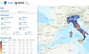
All data is published on the national IdroGEO platform, an easy tool to use, even with smartphones, to promote greater awareness of the risks affecting one's territory and informed decisions on where to buy one's home or locate new economic activities.
In 2021, ISPRA created the National Registry of in situ landslide monitoring systems in order to survey the monitoring networks on the national territory. It is managed in collaboration with Regions, Autonomous Provinces and ARPA and contains information on location, managing entity, monitoring purpose (cognitive/alert), system status (active/decommissioned/under construction), type of acquisition (manual/ continuously), type of monitoring instrumentation.
the Institute also provides technical-scientific support to the Ministry of the Environment as part of the PNRR SIM - Integrated Monitoring System (M2C4) and has promoted, together with the Regions and ARPA, the strengthening of the in situ monitoring networks of landslides on the national territory for the purposes of control and risk management.
In the National Repertoire of Soil Defense Interventions (ReNDiS) ISPRA manages information relating to all soil defense interventions financed with resources under the jurisdiction of the Ministry of the Environment and Energy Security, from 1999 to today. In ReNDiS, approximately 25,000 interventions are currently registered for a total of more than 17 billion euros in financing.

