Project MIRIFICUS
Monitoring of REforestation Interventions for the Urban Heat Island via Satellites
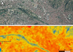
MIRIFICUS aims to analyze urban reforestation interventions through the use of high-resolution satellite data on a national and local scale, in order to provide Public Administrations with useful information to understand and evaluate the heat island phenomenon. The project aims to develop a geographic information tool (WebGIS) based on interactive maps that allow consultation of all the information made available. The project will allow to analyze the distribution/density of various urban elements that influence the Urban Heat Island (UHI) and in particular the superficial one, Surface Urban Heat Island (SUHI), will allow the evaluation of the effectiveness of reforestation interventions on some areas of study in the Municipalities of Rome Capital and Florence. MIRIFICUS is part of the “Innovation Program for Downstream Preparation - Public Administrations” – Call for Ideas “Effects of climate change and extreme events”.
This initiative aims to promote the development of innovative services based on the use of data and services of satellite telecommunications, navigation (NAV) and Earth Observation (OT) systems, also combined together in a synergistic way and integrated with data and services.
The final objective of the project is to promote the active involvement of Public Administrations, as end users of services, and, at the same time, allow an acceleration of scientific and technological development.
Duration of 24 months (27 July 2023 – 27 July 2025)
Partner
Proposing body: National Research Council, Institute for the Bioeconomy (CNR-IBE);
Partner body: ISPRA
Management and control of activities: Italian Space Agency (ASI);
Involvement of interest: ANCI, Municipality of Rome, Municipality of Florence.

