The Sinkhole Project
Studies and researches on natural sinkhole phenomena are being conducted in the last few years by the Land Protection and Georesources Department of the Geological Survey of Italy. These have involved the whole national territory.
The works have included an in-depth bibliographical research, a first collection of data aimed at making a census of sinkhole phenomena and on-site surveys. These led to the reconstruction of cavity morphologies and of the neighbouring geostructural, geomorphological and hydrogeological contexts.
At the moment, there is still an open debate regarding the definition of genetic mechanisms that determine such phenomena. The Geological Survey has therefore started perparing some guidelines for their more correct classification.
The project includes the following stages.
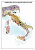
- Census of sinkhole phenomena that occurred in the national territory and collection of data
This stage has provided for an extensive national and international bibliographical research. The research was also conducted in specialized archives and libraries to find historical information. The aim was to find, evaluate and register data that has been published on this subject until today and analyse the acquired unpublished material. - Detailed geological, geomorphological and hydrogeological surveys in the sites of interest
Geological, geomorphological and hydrogeological surveys were carried out in the areas where sinkhole phenomena took place. More than 300 on-site surveys have been conducted in the identified risk areas in different Italian regions. The aim was to collect data to study the surrounding conditions as well as data regarding the cavities’ dimensions. These were obtained by using adequate instruments. The water existing in many cavities was also submitted to chemical analyses while paleontological analyses were carried out on the cover soil. - Photointerpretation of the neighbouring areas
In many risk areas, a multiscalar and multitemporal image analysis was conducted on the vast area surrounding the cavities. Particular attention was paid to tectonic elements of the affected areas as well as to quiescent and inactive forms. - Study of the genetic processes related to the geostructural, geomorphological and hydrogeological contexts leading to the formation of sinkholes
Identifying a genetic mechanism that is able to cause the formation of a sinkhole is an issue that has still not been resolved and is still an argument of debate among the scientific community. This is because many are the variables in the surrounding areas and the inducing and triggering causes of the phenomenon. Many hypotheses have been made after having studied and registered the phenomenon and they are getting always closer to identifying the genetic mechanism. To this purpose, it would be necessary to construct a model that takes into consideration all the surrounding physical, mechanical, hydraulic, geochemical and geological parameters. - Identification of guidelines for the classification of sinkhole phenomena
Considering the great confusion and the different interpretations on the subject, an adequate classification of sinkhole forms is necessary. It has therefore been proposed to make a first classification of the phenomena on the basis of the genetic mechanisms and a second classification that takes into account the surrounding geological and morphological aspects, according to Italian case histories. This challenge had never been attempted in Italy before. - Study of the cavities’ evolution and migration
It has been proved that cavities develop with time. They can fill up again and become extinct, in the absence of water deposits (but especially gas) in the soil. They often form in other sites, not far from the former, according to very specific mechanisms. It would be important to make more in-depth studies on the migration of water and gas upflows from the underground surface, considering that this process is most probably among the inducing mechanisms of the phenomenon of reference. - Archiving and digitisation of data
A census form of the phenomena was realized both on paper and digital format. A relational database was realized, by means of GIS, containing features of all the registered phenomena. - Risk study
Geological risk sheets of sinkholes in the whole national territory are being realized with the support of a GIS. These take into account the morphological features; the nature and thickness of the cover soil; the presence of active seismogenetic lines; epicentres and relative seismic intensities of earthquakes; the presence of mineral springs; water aggressiveness and the number of sinkhole cases. - Data processing and publishing
During the course of the project, some articles will be published and the results will be presented to national and international conferences. APAT has published a book containing records of the conference entitled: “State of the art on the study of sinkhole phenomena and the role of the state and local administrations in managing the territory”. A monograph is being prepared containing the results achieved for all national cases. Finally, data will be published on the web site and made publicly available.

